
Shorebird Survey
The Newfoundland and Labrador Shorebird Survey (A chapter of the Atlantic Canada Shorebird Survey (ACSS)) is an important initiative designed to evaluate the use of coastlines by migrating shorebirds, document areas of significant concentrations and identify habitats important to various species.

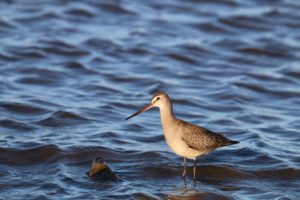
The Shorebirds
Shorebirds are small to medium sized birds with slender, probing bills and long legs. They are associated with water, but feed on open ground mostly by wading in or along the edge of shallow water using their bills to probe in mud or sand or to pluck food from the ground (Gill 1994). Shorebirds are a diverse group of birds that include Plovers, Sandpipers, Phalaropes, Snipe, Curlews, Godwits and Turnstones.
The threat
THREATS TO SHOREBIRDS
Worldwide there are events that threaten the existence of shorebirds. Just a few examples include:
• Loss of habitat due to urban expansion and changes in land use. Ocean front development has become a major issue in coastal communities leading to the degradation of coastal habitats.
• Global climate change due to increase of carbon dioxide and other greenhouse gases into the atmosphere is predicted to affect the distribution of most species, as well as their associated habitats. It is thought that coastal areas will experience higher frequency of storms and the interior may see an increase in natural fire cycles. Sea level rise may destroy vital staging habitat to migratory shorebirds (Galbraith et al., 2000; Galbraith 2001).
• Increased disturbance in shorebird habitat.
• Pollution; oil spills etc.
Survey Beaches
We are currently looking to collect data on shorebirds in the below list of beaches (we also enjoy other beach sightings as well!):
- Swift Current, Burin Peninsula
- Stephenville Crossing, St. George’s Bay
- St. Shott’s Beach, St. Shott’s, Trepassey Bay
- St. Shott’s Sod Farm, St. Shott’s, Trepassey Bay\
- Spaniards Bay, Conception Bay, Avalon Peninsula
- Shoal Cove West, Strait of Belle Isle, Ferolle Peninsula,
- Northern Peninsula St. Anthony
- Second Pond, Goulds
- Sandy Point, Flat Bay, St. George’s Stephenville
- Pouch Cove
- Portugal Cove South
- Fort Amherst
- Long Beach, Cape Race
- LaManche Provincial Park
- JT Cheeseman Provincial Park – Cape Barachois/Cape
- Ray, Southwest Coast, St. George’s Stephenville
- Hawke’s Bay, Northern Peninsula St. Anthony
- Garnish, Burin Peninsula
- Gambo,
- Flat Bay Peninsula aka Jento’s Island, St. George’s Bay
- Eddies Cove East – GMNP
- Eastport – Sandy Cove Beach, Sandy Cove, Bonavista Bay
- Chance Cove, Avalon Peninsula
- Carmanville, Hamilton Sound, Notre Dame Bay
- Cape Race Rd, Road leading to Cape Race light
- Cape Freels, Cape Freels North, Notre Dame Bay,
- Bonavista Bay
- Black Duck Brook, Port au Port Peninsula, Port au Port
- Bay, St. George’s Stephenville
- Big & Little Barasway, Burgeo, St. George’s Stephenville
- Bellevue Provincial Park, Bellevue Avalon
- Baie Verte, northeast coast
What is CPAWS doing
Please help us in our efforts. If you are interested in becoming a shorebird volunteer surveyor please contact us today!
Email: nlcoordinator@cpaws.org
Resources
![]()